
This publication is categorised as a CSO Frontier Series Output. Particular care must be taken when interpreting the statistics in this release as it may use new methods which are under development and/or data sources which may be incomplete, for example new administrative data sources.
Under Article 17 of the EU Directive on the Conservation of Habitats, Flora and Fauna (92/43/EEC) (the Habitats Directive), the National Parks and Wildlife Service (NPWS) report the conservation status of specific habitats to the European Commission. These habitats are known as Annex I habitats as they are listed under Annex I of the Directive. A lot of data on habitats is reported under Article 17, including their geographical range, spatial area, structure and functions, and conservation status. For more information, refer to the Article 17 Reports on the NPWS website.
Eight Annex I river and lake habitats occur in Ireland. Some of these habitats occur over a relatively small area. Table 4.1 below shows the extent as reported by the NPWS in the 2019 Habitat Assessment, while Maps 4.1 to 4.8 show their range and distribution. Note that there may be further areas as yet unmapped. These habitats are highly diverse and very valuable for nature and they provide a range of ecosystem functions.
| Table 4.1 Extent and distribution of Annex I river and lake habitats found in Ireland | |||
| Annex I habitat | Extent1 (estimated range; hectares) | Distribution | |
|---|---|---|---|
| Oligotrophic isoetid lake habitat (3110) | 39,900 – 41,600 | See Map 4.1 | |
| Mixed Najas flexilis lake habitat (3130) | 7,800 – 37,200 | See Map 4.2 | |
| Hard-water lake habitat (3140) | 28,300 – 46,400 | See Map 4.3 | |
| Rich pondweed lake habitat (3150) | 14,400 – 39,400 | See Map 4.4 | |
| Acid oligotrophic lake habitat (3160) | 2,650 – 3,650 | See Map 4.5 | |
| Turloughs (3180) | 5,680 – 6,340 | See Map 4.6 | |
| Chenopodion rubri (3270) | 118 - 145 | See Map 4.7 | |
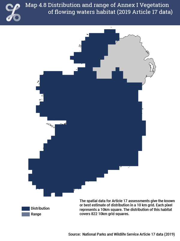
| Vegetation of flowing waters (3260) | 23,4002 | See Map 4.8 | |
| 1 NPWS estimated the range using datasets at different resolution (EPA WFD and Ordnance Survey Ireland Prime2) with a degree of uncertainty. The figures presented here are the best estimates for the 2013-2018 period. | |||
| 2 Based on the distribution of rivers, using Inland Fisheries Ireland (IFI) Wetted Area data. | |||
Maps outlining the distribution and range of each of the Annex I habitats are presented here, based on the spatial data available from the NPWS website. Distribution is based on the known or best estimate of the actual distribution of the habitat, while the range is drawn as an envelope around the distribution using a standardised procedure (for more information see Article 17 reports). Definitions for each habitat are based on the NPWS Article 17 reports.
The distribution and range of Annex I Oligotrophic isoetid lake habitat is shown in Map 4.1. This habitat has a widespread distribution in Ireland, and occurs in a large number of lakes. It is frequent in catchments where peatland overlies acid bedrock, and is best developed on gentle slopes along sheltered shorelines, but can also be found in upland lakes such as corries. It can co-occur with Acid oligotrophic lake habitat and Mixed Najas flexilis lake habitat. Ireland is a European stronghold for this habitat.

The distribution of the Annex I Mixed Najas flexilis lake habitat is shown in Map 4.2. It is a widespread habitat, particularly along the western fringe of Ireland. This habitat can co-occur with other Annex I habitats Oligotrophic isoetid lake habitat, Hard-water lake habitat, and Rich pondweed lake habitat in some lakes. The Mixed Najas flexilis lake habitat is of high conservation value, and Ireland is an important stronghold in a European context.

The distribution and range of Annex I Hard-water lake habitat is shown in Map 4.3. This habitat is strongly associated with lowland marl lakes over limestone bedrock. It can be found in lakes and ponds in turloughs, fens, parts of machair plains, quarries, and canals. Some of the best European examples of this habitat are found in Ireland.

The Rich pondweed lake habitat is generally found in the lowland, base-rich lakes in the midlands and north east of Ireland (Map 4.4). It is associated with large lakes in large catchments, for example in the Shannon system, and with small, naturally more nutrient-rich lakes such as those in the drumlin belt of Cavan, Monaghan and Leitrim, or the Burren.

The Acid oligotrophic lake habitat is associated with small ponds and lakes occurring in a mosaic with Atlantic and upland blanket bog and wet heath, generally along the western fringe of Ireland (Map 4.5).

Turloughs are restricted to areas of karst limestone (Map 4.6). Turlough communities can include other Annex I habitats, including the Hard-water lake habitat and Chenopodion rubri, as well as Alkaline fen and Limestone pavement.

The Annex I habitat Chenopodion rubri is mainly associated with riverine turloughs in Ireland, and it occurs where there is a late recession of flood water and summer flooding. It is also found, however, at Carrigadrohid Reservoir at the Gearagh, in county Cork (Map 4.7).

The Annex I habitat Vegetation of flowing waters has a broad definition, and covers a range of different types of rivers. In Ireland, this habitat occurs throughout the country (Map 4.8).
Learn about our data and confidentiality safeguards, and the steps we take to produce statistics that can be trusted by all.