Ireland's UN SDGs - Goal 15 Life on Land 2022
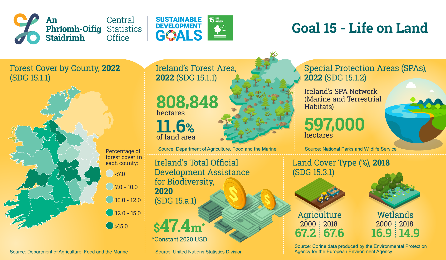
Ireland’s Forest Area, 2022 (SDG 15.1.1)
808,848 hectares
11.6 % of land area
Source: Department of Agriculture, Food and the Marine
Special Protection Areas (SPAs), 2022 (SDG 15.1.2 )
Ireland’s SPA Network (Marine and Terrestrial Habitats) 597,000 hectares
Source: National Parks and Wildlife Service
Ireland's Total Official Development Assistance for Biodiversity, 2020 (SDG 15.a.1)
$47.4 million
Source: United Nations Statistics Division
Land Cover Type (%), 2018 (SDG 15.3.1)
Agriculture:
2000: 67.2
2018: 67.6
Wetlands:
2000: 16.9
2018: 14.9
Source: Corine data produced by the Environmental Protection Agency for the European Environment Agency
Map Forest Cover by County (%), 2022 (SDG 15.1.1)
Louth 2.9
Monaghan: 4.6
Meath: 5.9
Dublin: 6.5
Kildare: 6.6
Wexford: 6.9
Westmeath: 9.1
Longford: 9.5
Carlow: 9.8
Kilkenny: 10.0
Mayo: 10.0
Cavan: 10.1
Galway: 10.4
Limerick: 10.5
Donegal: 11.8
Kerry: 12.1
Sligo: 12.1
Tipperary: 12.3
Cork: 12.4
Roscommon: 12.4
Waterford: 14.9
Laois: 16.6
Offaly: 16.7
Clare: 18.0
Wicklow: 18.5
Leitrim: 20.1
Total: 11.6
Source: Department of Agriculture, Food and the Marine