Your feedback can help us improve and enhance our services to the public. Tell us what matters to you in our online Customer Satisfaction Survey.
This publication looks at the population and the housing characteristics of residential dwellings within 10km distance of a border crossing into Northen Ireland and is based on a matching exercise involving:
This exercise uses an origin-destination routing algorithm, within a Geographical Information System (GIS), which identified the nearest border crossing location for dwellings on the Census 2011 and Census 2016 datasets using the official road network.
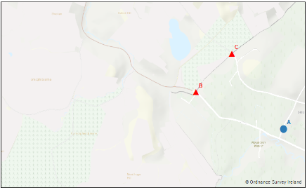
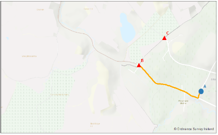
An example is shown below in Figures 1 and 2 to explain the workings of the routing algorithm. Figure 1 shows the location of a residential dwelling at point A, and two points at B and C which represent two border crossings, as well as the outline of the OSi road network. The routing algorithm identifies the nearest crossing point to the dwelling at A, which, in the example is point B, and then plots the shortest-path route and distance between A and B (marked orange in Figure 2).
Figure 1

Figure 2

This report complements the “Measuring Distance to Everyday Services in Ireland” publication which looked at how close or far away people in Ireland lived from common everyday facilities such as schools, hospitals, public transport, post offices and banks.
Learn about our data and confidentiality safeguards, and the steps we take to produce statistics that can be trusted by all.